Wild Weather Is Expected to Wallop West Texas
Storms are not an uncommon occurrence for residents who have long lived on the South Plains. But as the region enters the time of year best known as "severe weather season," I figured it might be time to give you a heads up on what we can expect tonight (Tuesday, March 12th) and tomorrow (Wednesday, March 13th) since the potential for damaging elements is present.
I try not to sensationalize the weather when a storm system is approaching unless absolutely necessary, and in the case of tonight's event, the same is true. Here are just some of the potential impacts to people and property that will occur as a storm system moves through the area overnight:
- Large Hail -- damaging hail up to 1.5" diameter
- Wind Gusts -- Sustained wind speeds between 20-30mph, with gusts up to 80mph
- Heavy Rainfall -- Even though accumulated rainfall amounts will remain less than 3 inches, the potential for brief periods of heavy rainfall could produce areal flooding on roadways.
- Debris -- Strong, gusty wind speeds translates into "blowing stuff." Trampolines will be airborne if not properly secured. Trees and power lines are subject to damage including falling on roadways.
- TORNADO - Yes, I said tornado. Though this risk is only at 2 percent probability for Lubbock County, the risk increases to 10 percent over the Permian Basin, which is close enough to home in order for people to stay tuned to local weather professionals.
The latest model data shows a squall line of thunderstorms entering Texas from New Mexico around 10 p.m. and moving through West Texas into the Abilene area by 3 a.m.

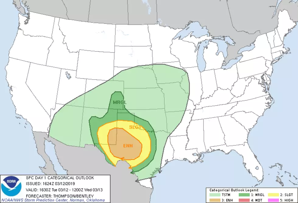
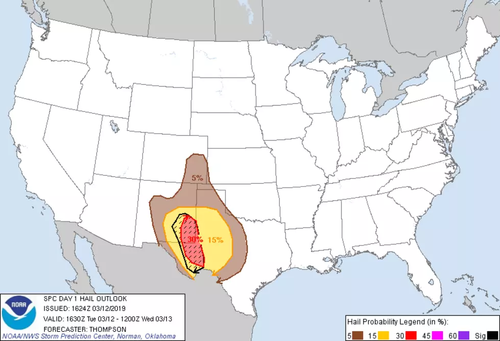
These graphics demonstrate where and what type of risks are involved with tonight's weather event from the geeky side of things, courtesy of a department of NOAA called the Storm Prediction Center.


It's important to remember to stay alert when the potential for severe weather exists. Another great resource for local alerts is the new LBKAlert system. If you haven't signed up for LBKAlert, you can do that here.
Some important quick tips to remember are:
- Turn Around, Don't Drown! - If you see water on roadways don't try to cross, find another path.
- Hear Thunder or See Lightning, Get Indoors - This is self explanatory. Don't get struck by lightning because you didn't move inside when the signs were there.
- Bring Precious Items Under Shelter - If you don't want hail damage or to find your precious fur baby lost and confused after a storm, put your vehicles and precious items in the garage or under a carport, and bring your pets inside.
Tomorrow will be one of the windiest days in years here on the South Plains with damaging wind speeds expected to remain the headline until late Wednesday.
More From 1025 KISS FM